
 Sale!
Sale! Historic Cape Cod Wall Map (1858) Poster Reproduction – Image Source International
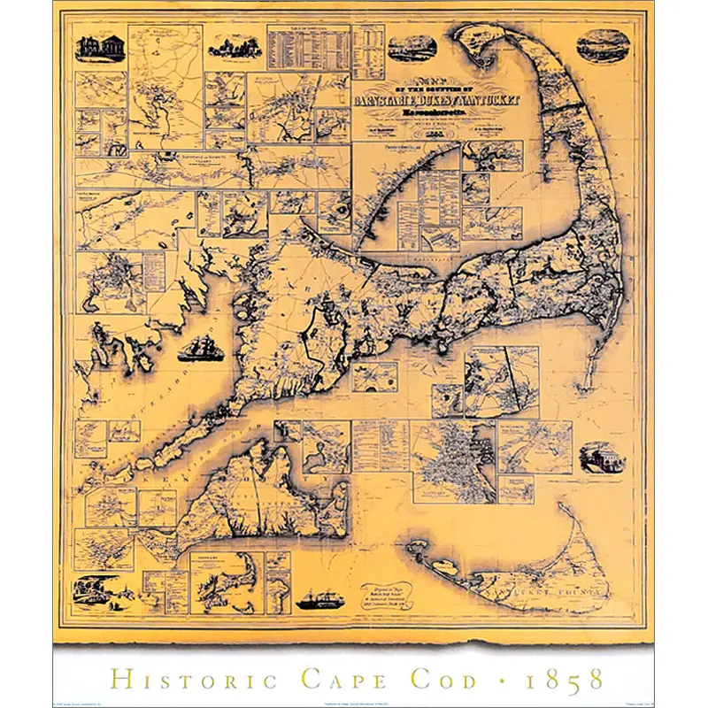
A spectacular print for the wall of any lover of New England's seaside paradise! This amazing poster features a reproduction of a vintage 1858 wall map from noted cartographer Henry F. Walling. Titled "Map of the Counties of Barnstable, Dukes and Nantucket
$24.95
-
$19.96
 100% Happiness Backed or Your Money Back
- Spend 30, Ship Free
- Love It or Return It Within 60 Days
Details
A spectacular print for the wall of any lover of New England’s seaside paradise! This amazing poster features a reproduction of a vintage 1858 wall map from noted cartographer Henry F. Walling. Titled “Map of the Counties of Barnstable, Dukes and Nantucket, Massachusetts”, you get the amazing golden hues of this more than 15-decade-old map, and all the great spots for vacationers, fishermen, and elites of all stripes: Cape Cod, Nantucket, Buzzard’s Bay, Chatham, Martha’s Vineyard, Saconesset, Sandwich, Harwich, Provincetown Village, Hyannis, Wellfleet, and more! The perfect decorative piece for the wall of home, office, summer house, or public facility.
Shipping Info
- Cost: $25
- Free Shipping
- We offer free shipping on orders over $30. Please check the free - shipping eligibility at checkout.
- Delivery Time:
- It usually takes [3-5] business days for standard shipping. Please note that this is an estimated time frame and may be affected by local holidays, and unforeseen circumstances.
Related products


Reviews
There are no reviews yet.